GPSMAP64s & Maps question

Joined
Apr 20, 2018
Messages
16
Reaction score
0
Hello,

I am considering replacing my Etrex (serial port version) purchased last century.
with a Garmin GPSMAP64s bundle (1:50k UK Discovery maps included).

I am only an occasionally hiker with my wife and dog.
We don't go off the beaten track and I always have a map and compass with me.

We generally do walks that are already published but sometimes the markers are a bit hard to see, or missing, or ambiguous.

Such as "turn left at the green tree!!!!!" a bit of an exaggeration I know but you get the idea,

My first thought is;

Are Garmin about to update this range with a Galileo enabled range?

More accurate from what I understand. 1m instead of 5m.


But my main question is;

Would the following be a sensible thing to do?


If I purchased Memory Map software with the 1:25k OS maps

Can I download areas of the 1:25k map into the memory of the 64s,
have the 1:50k SD card installed in the 64s?


And be able to use the 25k maps and the 50k maps as appropriate?

If I am physically in the area of the 25k map that I had downloaded into the device
I can use the 25k map but if I venture further a field can I switch to the 50k map?


Or have I misunderstood how it all works.


Can I do the same things with downloaded maps from MEMORY MAP that I can with the SD card maps?


How big a map area can I download into the 64s using the 25k maps?

I am visiting Keswick in the Lake District soon so it would be nice
to get as much area around Keswick into the 64s as possible.

Or is there a better solution?

Maybe use Garmin's Basecamp software, I assume I would have to buy 1:25k maps for this. The base map is 1:100k or something like that. No use for hiking really.

But would this be a better option?

Garmin software for a Garmin device!

Any suggestions would be most appreciate before I spend my cash.

Thanks
 
The GPSMap64 can already receive signals ftom both GPS (USA) and GLONASS (Russian) satellite constallations and there are some cell phones and tablets that can also receive signals from BEIDOU (China) satellite constellation, Galileo is has been in development for a long time and is still not really available to the GNSS user

Although there is an advantage to having access to multiple GNSS constellations, it's hard to say how much a forth constellation would help accuracy, you would probably need to wait for the next genration of 'Dual Band' devices to come onto the market to see a significant improvement in accuracy

You can get 1:50000 (not sure about 1:25000) OS. Maps that can be installed onto Garmin devices, but I don't think that the Memory Map computer program can transfer maps, this quote is from their website :-

When using Memory-Map and a Garmin GPS device you can transfer overlay data (routes, tracks, and waypoints). You can not transfer the Memory-Map map data as Garmin do not support this function.
 
Thank you for the reply.

i was hoping the Galileo system would act, not so much as a 4th system, but a more accurate system the hand-held unit could use to over-ride the "lower" accurate GPS/Glonass.

Basically, I am trying to avoid buying a device now for my August holiday (i will need time to practice with it) only to find that in a few months time a new and better device has been released.

As far as Memory Map goes.

It looks like I have totally misunderstood. I thought I could download the maps as well. I will take a closer look.

thanks, you may have saved me wasting some money.
 
Sorry to sound dismissive of Galilieo but it has been put forward as the 'only' alternative to GPS for the best part of 20 years, they were talking about it in 1999, lauched a single satellite for it in 2005, had 4 satelites by 2014, had 11 satellites in orbit by 2017 (not all working) and currently have 14 in orbit ( only 10 of which are working), they often give figures for how accurate it will be when all 30 satellites are in orbit and working (latest estimated date for this is some time after 2020), and never give figures for it's accuracy without the other existing satellite systems helping it out, so eventually it will contribute to greater accuracy

The only mention of actual products using Galileo I can find is the European car manufactures and even they don't seem to have any real dates, I think it is very likely that dual band receivers (which can use Galileo when available, but don't rely on it) will be the the first products you will see that will utilize Galilieo, when they arrive you can expect an accuracy of 2 - 3 inches, possibly 10 times better than the 3 feet suggested for a standard Galileo product
 
Hi,

this page states that there are 14 working and others in various other states.
https://www.gsc-europa.eu/system-status/Constellation-Information

i think Garmin has a runners watch, https://buy.garmin.com/en-US/US/p/572639 which has Galileo support.

this is why i thought it might be sooner rather than later that they may make a hiking unit with Galileo support.

but all i see on the web is guesses.

so if it is to be around about 2020 then i may as well get a 64s now.

thanks for the info.

thank
 
To be fair Gailileo will be of some use before 2020 as it doesn't need all 30 satellites to be useable, devices can use a mix of 'visible' satellites so even one or two can be of an advantage if they are in the right place, for some reason companies that make stand alone GPSs are slower to use newer receives than cell-phone / tablet makers, I suppose they do more testing for reliability, there is a link (Click HERE), on Garmin's position on Galileo, my guess is units will require a software update before they will use any built-in Galilieo chips
 
thanks for the insight.

is it worth leaving the WASS/EGNOSS switched on in the UK?

i think WASS only works in north America.

is EGNOSS actually active in the UK yet or is this part of the Galileo roll-out?

thanks
 
Egnoss is working in the UK, if you have something that displays satellite numbers look for 33, 36 or 49, the WAAS/Egnos satellites are different to constellations like GPS, GLONASS etc, which are constantly circling the earth, they are single satellites that 'hover' above the same spot on earth, like TV satellites, WAAS is only for the USA area and Egnos is only for Europe

These SBAS satellites were around in the days when there was only one 'GPS' constellation and their job is to relay correction info. to improve the accuracy of the 'moving' satellites, they 'hover' above the equator so in the UK you need a clear view of the southern sky
 
Thanks for the advice about keeping a clear view of the southern sky.

I have just taken my very, very old, Etrex serial, out with the dog and I can not see any satellite numbered above 32.

But as my old Etrex does not support Egnoss, well there is no mention of it in the manual, I guess I'm not surprised I don’t see 33 or 38.

Do I need to see multiple satellites for Egnoss to work or will one be ok.

I assume 33, 36 and 49 are the geo-stationary satellites you talked about.

Thanks
 
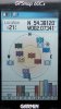
As you say the orginal Etrex (mine displays C 1999 - 2002) on power up, can't handle Egnos, you only need one Egnos satellite, my Samsung Tablet sees 33, 36 and 49, but my Garmin GPSmap60Cx only seems to select one of them, the 'D' icons you can see in the image tells you that Differential Correction has been applied to the data, this correction is supplied by '33'

Egnos.jpg
Click Image for more detail

EDIT
I have corrected an error in the Egnos satellite numbers
 
thanks for the advice.

i purchased a 64s with the Discovery UK 1:50k memory card today.

Now i just have to work out how to use it.

i think i will have some specific questions about various functions so i will start new links as appropriate.

thanks again.
 

Members online

Back
Top