Hi
Please assist somebody.
I am taking UTM coordinates using a Samsung Note 9+ and an app UTM Geo Map (looks like a good App). I had my land surveyed by a surveyor. I then compared the results of the two. Eastings measurements align - however the Northings are out by a constant factor of about 300m. I got a friend who has a hand held gps receiver and the readings confirmed the surveyors readings.
I am perplexed by this difference in these measurements. When I check my location on Google maps - the goole images line up with my location very well - meaning my GPS location is accurate.
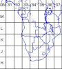
Is there something on my app or device that I must adjust for? Maybe something to do with Zone as it reads 36K?
Please assist somebody.
I am taking UTM coordinates using a Samsung Note 9+ and an app UTM Geo Map (looks like a good App). I had my land surveyed by a surveyor. I then compared the results of the two. Eastings measurements align - however the Northings are out by a constant factor of about 300m. I got a friend who has a hand held gps receiver and the readings confirmed the surveyors readings.
I am perplexed by this difference in these measurements. When I check my location on Google maps - the goole images line up with my location very well - meaning my GPS location is accurate.
Is there something on my app or device that I must adjust for? Maybe something to do with Zone as it reads 36K?